Medical Ministry International in Honduras

In the early 1970’s, Dr. Napolean Alcerro (the third Vice President of Honduras), had a vision to help those living in poverty in his country and provide a source for basic medical care. He then secured an official invitation to bring a Medical Ministry International medical brigade to Honduras.
Daniel and Ruth Castro have provided leadership for over 20 years for Medical Ministry International's one and two week projects.
Thank you to Gustavo & Mildred Elicegui for serving as project directors from 2004 to 2021.
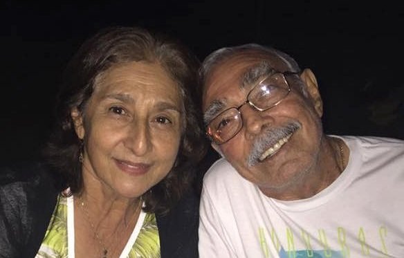
Ruth & Daniel Castro
Since 2004, Gustavo & Mildred Elicegui have served as Project Directors in Honduras. Mildred is a Family Practice Physician and serves on our project teams. They live in San Pedro Sula and have two boys.

Gustavo Elicegui
Project Sites:
-
Corquín is a municipality in the Honduran department of Copán. The population of Corquín is approximately 17,147. Copán is well known for its tobacco and fine cigars.
Project Description
Teams stay in a camp center on this project. Each day, a mobile clinic with a triage area, consultation rooms, dental area, eye examination area, and health education area is set up. The conditions of the facilities where we set up clinic are very simple and basic. Many of the patients that come do not receive regular medical and dental care, so all kinds of health problems can be seen. Common complaints include gastritis, arthritis pain, lower back pain, skin problems, and dehydration.
Elevation
1435m (4707ft)
Climate
Corquín's climate is classified as tropical. The summers have a good deal of rainfall, while the winters have very little. -
Erandique is one of the several municipalities of the Lempira department of Honduras. Erandique is surrounded by pine forests with some pockets of Sweetgum trees. Many of the pine forests are still used as a source of biofuel for the local population. The terrain is rugged, characterised by steep hills. The coffee plantations have great importance to Erandique, and there is also agricultural production of corn and beans, as well as some vegetable crops and small herds of cattle. Erandique is one of the most economically poor places in Honduras.
Project Description
The clinic will be held in the Local Communal Center of Erandique Lempira. The MMI Honduras team and their local partners are working hard to have this mission well run and organized. Each day, a mobile clinic with a triage area, consultation rooms, dental area, eye examination area, a Pharmacy, and health education area is set up. The conditions of the facilities where we set up clinic are very simple and basic. Many of the patients that come do not receive regular medical and dental care, so all kinds of health problems can be seen. Common complaints include gastritis, arthritis pain, lower back pain, skin problems, and dehydration.
Elevation
1,280 m (4,199 ft)
Climate
The weather is cool during the rainy season (May–October), and warmer in the dry season. -
Florida, Copán is a small rural town (population about 5,500) located in the west side of the Honduras. MMI has a partnership with the local Church and City hall. Tobacco, corn, and cattle are the main source of income for the farmers in Florida. Florida is about 2 ½ hours from San Pedro Sula.
Project Description
MMI and our Honduras Director work in partnership with the local city hall and the local church in Florida. Each day, a mobile clinic with a triage area, consultation rooms, dental area, eye examination area, a Pharmacy, and health education area is set up. The conditions of the facilities where we set up clinic are very simple and basic. Many of the patients that come do not receive regular medical and dental care, so all kinds of health problems can be seen. Common complaints include gastritis, arthritis pain, lower back pain, skin problems, and dehydration.
Elevation
483.17 m (1585.22 ft. )
Climate
The climate is hot and humid. -
La Ceiba is a port city in the department of Atlántida on the northern coast of Honduras. The population of 200,000 are largely involved in commerce and agriculture, specifically pineapple. Eco-tourism is also extremely popular in this city, and highlights include: mountain treks, river rafting, and Caribbean beaches. La Ceiba is home to members of the Garifuna minority in Honduras, who are decendents of immigrants. La Ceiba was named after a giant ceiba tree which grew near the old dock, which itself finally fell into the sea in late 2007. The local population originally referred to the large tree as "the ladder God used when he came down from Heaven to visit Earth".
Project Description
Teams usually stay in a hotel on these projects and work in surrounding villages. The projects focus on medical, dental, optometry, and physiotherapy. The conditions of the facilities where we set up clinic are very simple and basic. Many of the patients that come do not receive regular medical and dental care, so all kinds of health problems can be seen. Common complaints include gastritis, arthritis pain, lower back pain, skin problems, and dehydration.
Elevation
3 m (10 ft.)
Climate
Hot and humid.
Large amounts of rainfall, especially during October - February. -
Omoa is municipality and small town located along the Northwest Caribbean coast of Honduras. The population is approximately 45,000.
Project Description
These projects provide mainly Dental, Preventive, Primary, and Optical care in the villages surrounding Omoa.
Elevation
332m
Climate
Omoa's climate is tropical. The average monthly temperatures are very hot and humid. -
Quimistán is located in Santa Bárbara and is one of the 18 departments into which Honduras is divided. Quimistán has 51,160 (2015) inhabitants which represent 13.85 % of the population of Santa Bárbara.
Project Description
These projects provide care to several villages surrounding Quimistán, Santa Barbara, and provide mainly medical care, preventive and primary care, dental care, and optometry. On these projects, teams stay in a Christian camp and work in different surrounding villages each day.
Elevation
183 m (600 ft)
Climate
The average monthly temperature in June is a high of 33 °C (91°F) and a low of 24°C (75°F) The weather will be warm but in the evenings cooling off a bit approximately 75- 80 °F (evening) 85-95 °F (daytime). -
San José is a municipality in the Honduran department of Copán. Copán is well known for its tobacco and fine cigars. In 2015, the population of San José was 7,090.
Project Description
The project is intended to provide Health Education, Primary Care, and Dental Care to patients in the area. The team and MMI’s Honduras Director often work in partnership with local city halls, community centers, and churches. Each day, a mobile clinic with a triage area, consultation rooms, dental area, eye examination area, a pharmacy, and health education area is set up. The conditions of the facilities where we set up clinic are very simple and basic. The team will treat patients dealing with a variety of issues. In the past, the most common services we provided included dental cleanings and restorations, minor procedures (ex. parasite treatment), lab tests, prescriptions, and vision screenings and exams.
Climate
Tropical -
San Luis is a municipality in the Honduran department of Santa Bárbara. San Luis has a population of about 25,000. Its economy is based strongly around coffee farming. San Luis is in a region with many pine-covered hills.
Project Description
These projects provide services in a clinic in San Luis, Santa Bárbara, and provide mainly Medical care, Preventive and Primary care, and Dental care. Teams usually stay in a local hotel.
Elevation
1,037 m (3,402 ft.)
Climate
The average November temperature ranges from a high of 27 °C (81°F) to a low of 16°C (61°F). Warm but in the evenings cooling off a bit. -
Tela is a coastal city 94 kilometers from San Pedro Sula on the Caribbean sea. It is located in the department of Atlantida. Tela has a population of about 99,294.
Project Description
Teams work in the surrounding villages of Tela to provide mainly Medical care, Preventive and Primary care, and Dental care.
Elevation
3 m (10 ft.)
Climate
The average temperature ranges from a high of 31°C (87.8°F) to a low of 21°C (69.8°F). -
Zacapa is located south of the department of Santa Barbara. It has several rivers such as Ulua, Jaitique, Zacapa, and Canjel. Tourists visit Zacapa for its hot springs, waterfalls, caves, and inactive volcano called "Cerro Cargamón." In 2012, Zacapa had a population of 1,065.
Project Description
The project is intended to provide Health Education, Primary Care, and Dental Care to patients in the area. The team and MMI’s Honduras Director often work in partnership with local city halls, community centers, and churches. Each day, a mobile clinic with a triage area, consultation rooms, dental area, eye examination area, a pharmacy, and health education area is set up. The conditions of the facilities where we set up clinic are very simple and basic. The team will treat patients dealing with a variety of issues. In the past, the most common services we provided included dental cleanings and restorations, minor procedures (ex. parasite treatment), lab tests, prescriptions, and vision screenings and exams.
Elevation
120 m (390 ft)
Climate
Tropical savanna, wet.

Travelling on a Project
-
Travelers must present a passport, which must be valid for at least six months beyond the date of expected departure. Departure tax of $40 USD is required upon exit for all international flights, but this is often included in your tickets. Please ensure you have this cash with you just in case.
Tourist visa is not required. Proof of yellow fever vaccination is required, if you have visited a country where yellow fever occurs. For a list of countries please see:
• Americans: Proof of return or onward travel is required. For more information see the US State Department website:
https://travel.state.gov/content/passports/en/country/honduras.html
• Canadians: Please check the following website for the most current entry/exit requirements:
https://travel.gc.ca/destinations/honduras
• International: Please contact MMI office or Globespan Travel Management for visa requirement if needed.
-
Description text goes here
-
Description text goes here
Centro Cristiano de Servicios Humanitarios de Honduras (CCSHH)

Centro Cristiano de Servicios Humanitarios de Honduras (CCSHH) is located in El Progreso, Honduras. Established in 1997 by the late Dr. Douglas Perry and his wife Maxine in collaboration with Rev Daniel and Ruth Castro, Directors of Sociedad Medica Cristiana and funded by Medical Ministry International and the Church of the Palms in Sarasota, Florida. Melvin Tejada serves as the Hospital Director.
In June 2017, the CCSHH Eye Clinic developed a pediatric ophthalmic unit. The area serves more than 3,000 children per year with various visual pathologies. The pediatric unit has two examination rooms adapted especially for children, as well as a waiting room which is a growing project. With this new unit, CCSHH now has the opportunity to host visiting pediatric ophthalmologists that would like to be involved with CCSHH. The CCSHH also celebrated their 20 year anniversary in 2017.
This clinic treats approximately 12,000 patients a year.
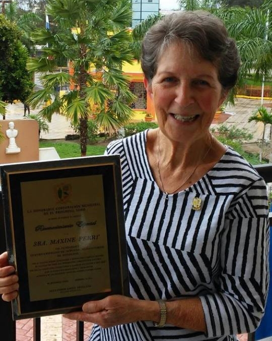
Maxine Perry, Co-founder

Dedication of new Pediatric Renovation
Patient Story: Ángel Gabriel
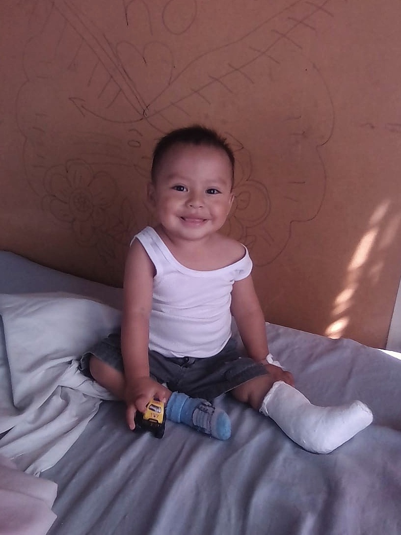
Pictured left: When Ángel Gabriel was born, his umbilical cord was wrapped around his leg, causing malformation of the muscles. He underwent multiple surgeries, but they didn't appear to improve any function.
In November 2018, Ángel (20 months old) and his mother came to the MMI clinic in Corquín Copán. After being seen by one of the Honduran doctors, Dr. Maritza López Oviedo, it was determined another surgery (equinovarus foot surgery) could help.
Ángel’s mother provides for her family by cutting coffee in the harvest season, but this income was not enough to afford the necessary surgery for Ángel. Dr. Oviedo explained the situation to the MMI project team, and they generously provided money for the surgery, as well as food and transportation.
In January, with coordination from MMI Honduras Director, Gustavo Elicegui, Ángel received the surgery he needed. The surgery was successful!
In the words of Charlotte, an MMI volunteer on the Corquin Copan project: “More surgery and therapy may be needed, but with God's love and the help of those around him, he will live a happy and productive life.”
About Honduras
COUNTRY BACKGROUND
Honduras, officially the Republic of Honduras, is a republic in Central America. Honduras has a population of approximately 8 million people with primarily Spanish ancestry, alongside small amounts of Garifuna and Mesoamerican Mayan descendants. The economy has one of the highest growth rates in Latin America, but wealth polarization and unemployment are also high. According to the Human Development Index, Honduras is the sixth least-developed country, and 50% of its population live below the poverty line. Hurricane Mitch in 1998, floods in 2008, and the constitutional crisis in 2009 has meant that infrastructure and development has suffered.
However, Honduras is emerging on the global stage as a textile exporter and tourist destination. Honduras is particularly known for its variety of climate zones: interior mountains, Carribbean and Pacific coasts, and Carribbean islands. The region is considered a biodiversity hotspot because of the many plant and animal species found in the reserves, rain forests, cloud forests, mangroves, savannas, and mountain ranges. Roátan in the Bay Islands, as home to the world’s second-largest coral reef, is particularly valued for it pristine and inexpensive experience. Honduras is also a historical hot-spot for Mayan ruins, and known for its love of football.
LOCATION:
Central America, between Guatemala and Nicaragua
GEOGRAPHIC COORDINATES:
15 00 N, 86 30 W
MAP REFERENCES:
Central American and Caribbean
TOTAL AREA:
112,492 km²
BORDER COUNTRIES:
Guatemala, El Salvador, Nicaragua
COASTLINE:
823 km (Caribbean Sea 669 km, Gulf of Fonseca 163 km)
MARITIME CLAIMS:
12 nautical miles
CLIMATE:
Subtropical in lowlands, temperate in mountains
TERRAIN:
Mostly mountains in interior, narrow coastal plains
ELEVATION EXTREMES
LOWEST POINT:
Caribbean Sea - 0 m
HIGHEST POINT:
Cerro Las Minas - 2,870 m
